Last Updated on November 12, 2025 by Olasunkanmi Olajide
By Ridwan Sulaiman & Bode Olanrewaju
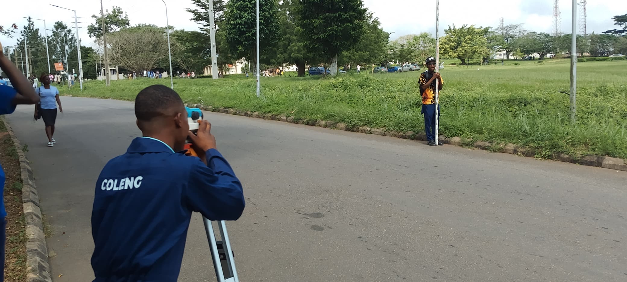
College of Engineering (COLENG) students of the Federal University of Agriculture, Abeokuta (FUNAAB), have conducted a practical field exercise on surveying and photogrammetry at the University’s Ring Road along the Postgraduate School. The exercise formed part of their fieldwork training aimed at enhancing their technical competence and practical understanding of land measurement and analysis.
During the session, the students engaged in leveling using the rise and fall method to determine the slope and profile of the land within the Postgraduate School premises.
Speaking on the exercise, one of the participants explained that the activity focused on determining the slope of the land through surveying to ascertain how much filling would be needed to achieve a level surface. He described leveling as a process used to measure both the vertical and horizontal distances of a land area in order to determine its reduced level, elevation, and gradient.

The instruments used during the exercise included the Theodolite, for measuring horizontal and vertical angles; a tripod stand, which supports the Theodolite; and a ranging rod, used for determining height above ground level.
One of them further highlighted the importance of levelling in engineering practice, noting that it aids in determining the Mean Sea Level (MSL), establishing control points, plotting land profiles, and supporting pegging and site preparation activities within the University.
The exercise provided students with hands-on experience, reinforcing classroom knowledge with practical exposure to field instruments and techniques essential for professional engineering practice.